Kaleto
Kaleto: the canyon that is not a graben.
The official name of the protected area preserves one interpretation, while modern geology tells another. This page brings both parts of the story together from official and academic sources.
Status
A protected natural monument since 1961.
The site is officially registered under the name Tectonic Graben Kaleto, with code 13 in the protected-area register. It has been protected since 1961. Its area was updated by Order RD-220 of 19 March 2024 of the Ministry of Environment and Water, published in State Gazette issue 37/2024, and the registered area is 65.88 hectares.
Geology
A karst canyon about 600 metres long.
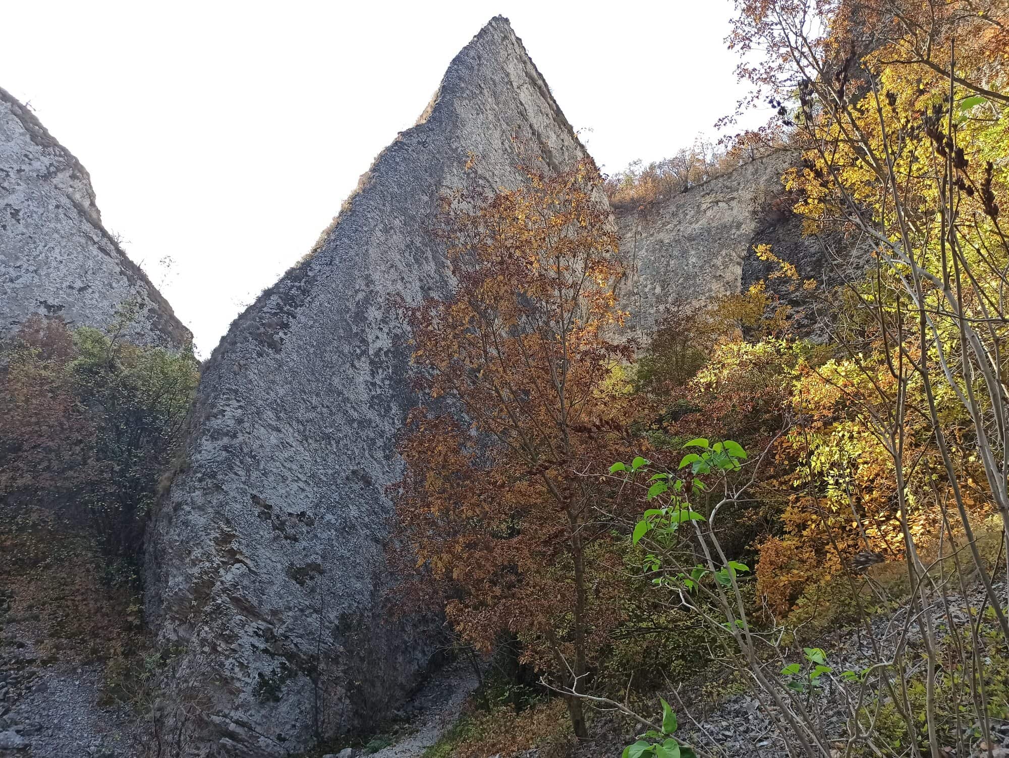
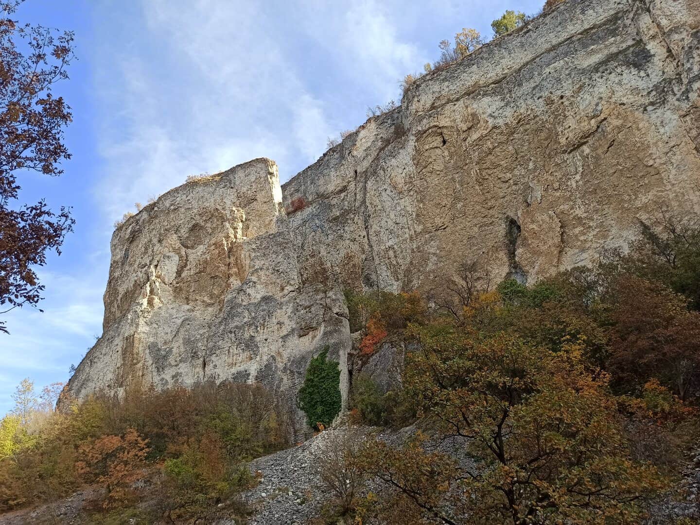
The University of Mining and Geology describes Kaleto as a karst canyon about 600 metres long, filled with enormous collapsed limestone blocks. The limestone formed approximately 68 to 72 million years ago, during the Maastrichtian age of the Late Cretaceous.
The dimensions
About 60 metres deep, up to 100 metres wide.
In the 2008 Annual of the University of Mining and Geology, Sinyovski and co-authors describe Kaleto as a canyon in the limestones of the Mezdra Formation about 600 metres long, about 60 metres deep and up to 100 metres wide. The site uses the university’s dimensions with the source named.
The name
Why the name and the explanation differ.
Later geological work by the University of Mining and Geology rejected the original tectonic-graben explanation. The current description is of limestone dissolving along vertical fractures, a karst gorge forming, and enormous limestone blocks later collapsing into the canyon. The legal name of the protected area remains unchanged.
The fortress
Kale means fortress.
Cherven Bryag Municipality lists a late antique and medieval fortress "Kaleto" near the village of Reselets among its archaeological monuments, and its village profile names an ancient fortress Kaleto in the territory. In August 2021 a field survey of Cherven Bryag Municipality led by archaeologists of the National Archaeological Institute with Museum of the Bulgarian Academy of Sciences and the Regional Historical Museum in Pleven recorded above-ground structures of a late antique fortress in the Kaleto locality in the land of Reselets. The natural monument is the canyon; the fortress is a separate cultural site in the same locality, and the site does not claim that the two share one boundary. Details of plan, walls or dating will follow once the original report has been checked.
Context
Part of a network of geotopes and protected zones.
Kaleto is one of four geotopes around Reselets included in the Register and Cadastre of Geological Phenomena in Bulgaria, together with Skalnite Kukli, Reseletskite Kukli and Kupenite. The protected area also overlaps both Natura 2000 zones: Karlukovo and Karlukovski karst.
On site
Part of the wider landscape of the area.
The university source also lists the Kaleto forest park as part of the wider natural landscape around the village. This site does not maintain trails and offers no tourism services: for current visitor information, check the Cherven Bryag Municipality pages.