Skalnite Kukli in Pladnishteto
Skalnite Kukli in Pladnishteto: the protected territory in the Rachene valley.
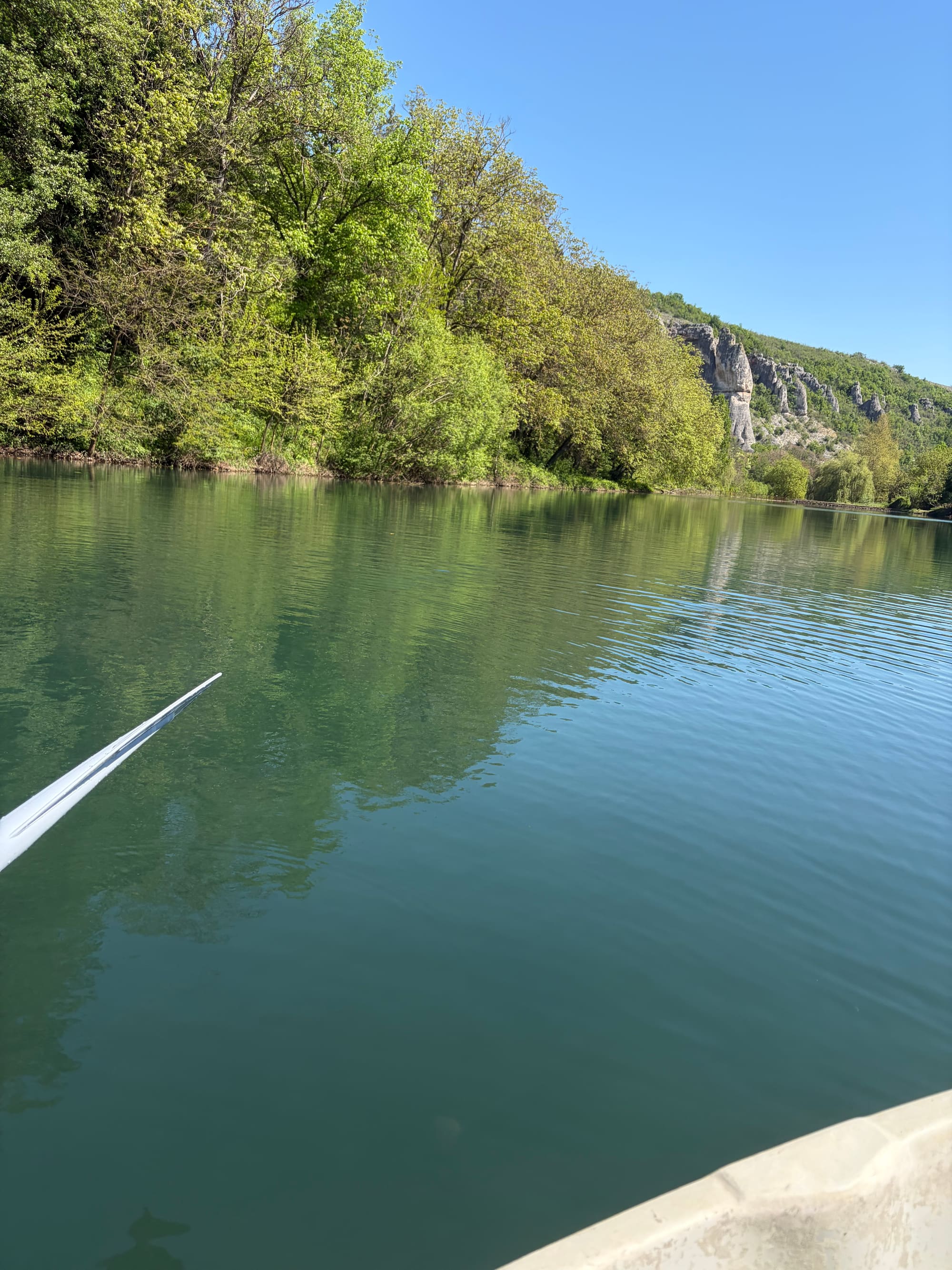
A separate natural monument, distinct from Kuklite in Uleya and from Kupenite. Its boundary includes the parcel of the municipal reservoir, which explains why the rock rim around the reservoir is associated with this name.
Status
A protected natural monument since 1972.
Declared by Order No. 3702 of 29 December 1972, published in State Gazette issue 13/1973, with code 157 in the protected-area register. The boundary was updated by Order RD-785 of 20 December 2018, State Gazette issue 12/2019, and the current area is 64.42 hectares. The territory overlaps both Natura 2000 zones, Karlukovo and Karlukovski karst.
The place
Rock figures in the Rachene valley.
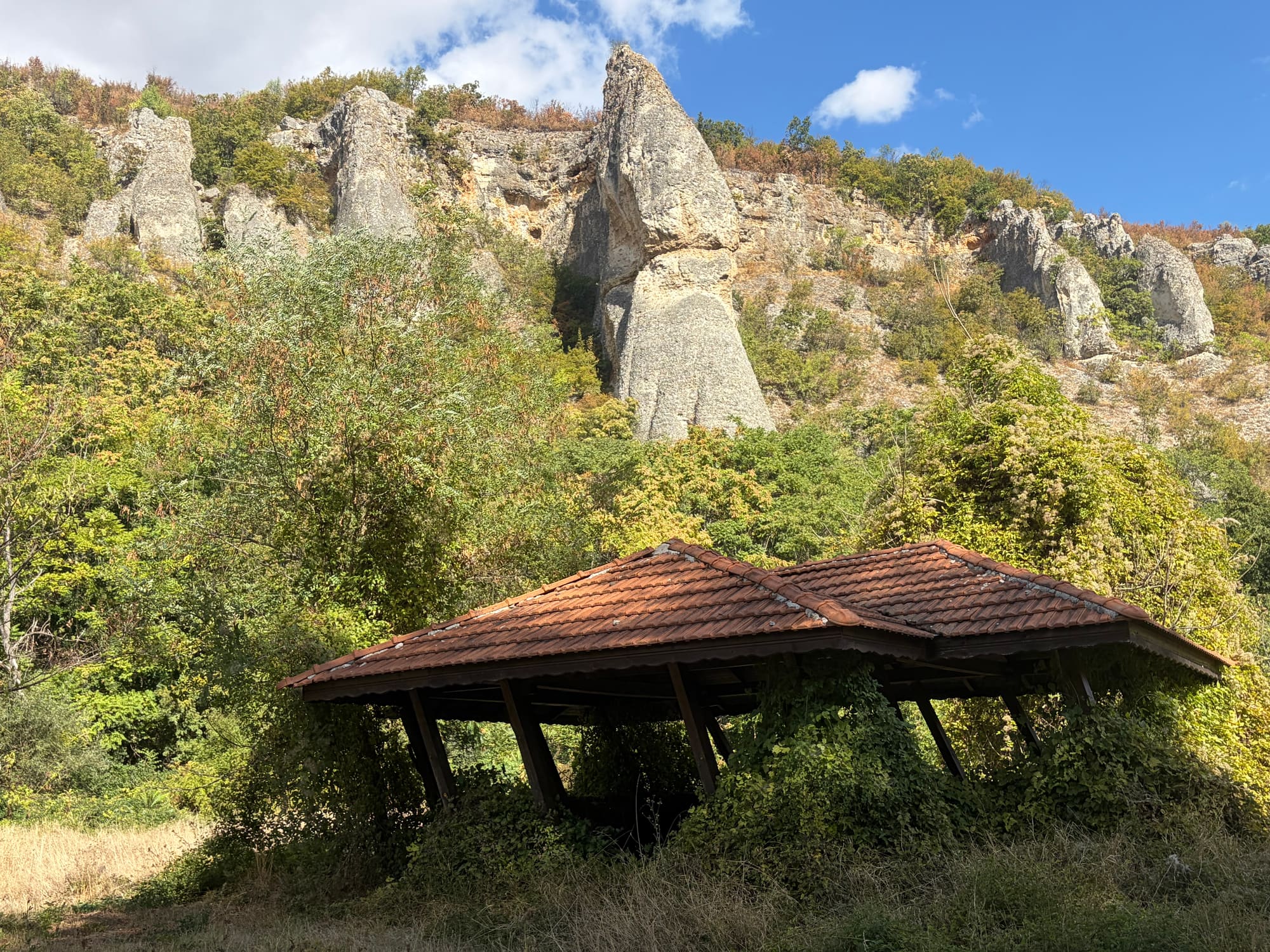
The Regional Inspectorate of Environment and Water in Pleven describes the site as rock formations in the Pladnishteto locality, in the Rachene valley, with numerous figures that can resemble people, animals and other forms. Which rock carries which name, the site does not claim.
The reservoir
The boundary includes the parcel of the municipal reservoir.
The updated cadastral boundary of the protected territory includes the parcel of Reselets reservoir, public municipal property operated by AQUAVIO ltd. under concession. The concession concerns the reservoir, not the protected territory: the operator is not the owner and holds no rights over the rocks, the paths or the surrounding land. The protection regime is set by the order and applied by the competent authorities.
The name
Why it is also called "Reseletskite Kukli".
The municipal tourism project of 2011-2013 describes a route from Kaleto through Pladnishteto, over a wooden bridge across the Rachene, to "Reseletskite Kukli" and the artificial lake Barazha. Tourism texts since then have used that name for this rim, while the register keeps the separate name Skalnite Kukli in the Pladnishteto locality and the University of Mining and Geology calls the geotope in Uleya Reseletskite Kukli. The full explanation is on the overview page.
The route
A historical trail, an unverified present.
By 2013 the project had built an alley, pedestrian bridges and small-scale visitor infrastructure along the route, and the ecotrail was opened in the Barazha locality on 6 April 2013. The site has not checked the current condition of that infrastructure or of the path through Pladnishteto and publishes no access guidance.
The photographs
The landscape of the area, not individual figures.
The lead photograph shows the reservoir and the limestone landscape in the Pladnishteto area, seen from the water. The gallery frames were taken from the road above the eastern shore of the reservoir, looking west, and show rock pinnacles on the slope above a shelter; the camera position and bearing were compared with the official digital boundary of the protected territory, which runs 100 to 300 metres ahead of the camera. The site presents every frame as the landscape in the area of the protected territory and captions no rock with the name of a figure. How the limestone takes such forms is told on the landscape page.